Virtual Fieldtrips
In this section the user would find the link to a folder that contains the kmz file with a Virtual Fieldtrip to be run on Google Earth. Each one of them contains the geolocation of the main analysed field localities, geological maps, and cross-sections of each research published by the authors in diverse regions around the globe.
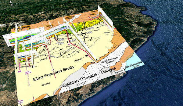
SE Pyrenees fold thrust belt
Vergés PhD thesis 1993: Estudi geològic del vessant sud del Pirineu oriental i central. Evolució cinemática en 3D. PhD Thesis University of Barcelona, 1-199.
Virtual Fieldtrip of Google Earth with the geolocation of 15 balanced and restored cross-sections used to reconstruct the 3D evolution of the SE Pyrenees fold and thrust system. Assembled by Cristina Martínez.
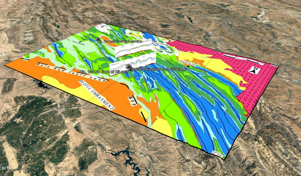
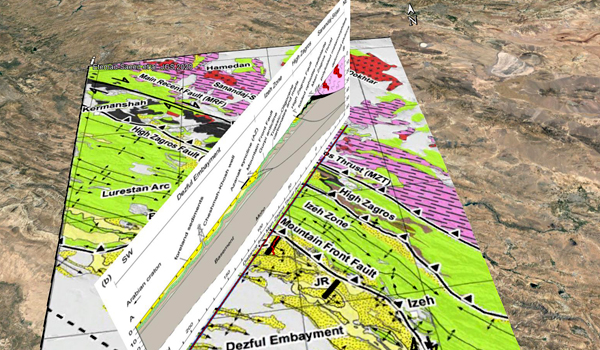
SE Lurestan, Zagros, Iran
Casciello et al., 2009: Fold patterns and multilayer rheology of the Lurestan Province, Zagros Simply Folded Belt (Iran). Journal of the Geological Society, London, Vol. 166, 2009, pp. 947–959.
Virtual Fieldtrip on Google Earth with Elevation Exaggeration = 1) with the geolocation of the main analyzed field localities, geological maps, and cross-sections from the structure of the fold patterns and multilayer rheology of the Lurestan Province, Zagros Simply Folded Belt (Iran) published in the Journal of the Geological Society by authors. Assembled by Cristina Biete.
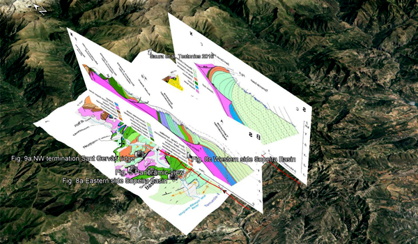
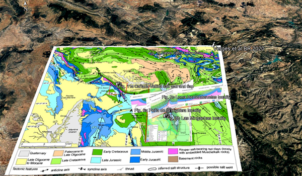
Sopeira and Sant Gervàs Lower Cretaceous diapiric evolution, Southern Pyrenees
Virtual Fieldtrip on Google Earth with Elevation Exaggeration = 1 with the geolocation of the main analyzed field localities, geological maps, and cross-sections from the Rising and falling diapirs, shifting depocenters, and flap overturning in the Cretaceous Sopeira and Sant Gervàs subbasins (Ribagorça Basin, southern Pyrenees) paper published in Tectonics by the authors. Assembled by Cristina Martínez & Cristina Biete.
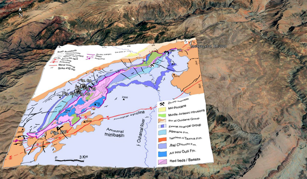
Fieldtrip to Tazoult salt-wall, Central High Atlas, Morocco
Virtual Fieldtrip on Google Earth with the geolocation of the main analyzed field localities, geological maps, and cross-sections from the diapiric growth within an Early Jurassic rift basin: the Tazoult salt wall (Central High Atlas, Morocco) paper published in Tectonics by the authors. Assembled by Cristina Martínez.
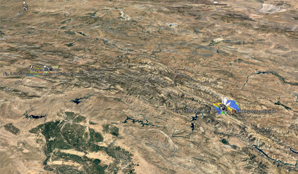
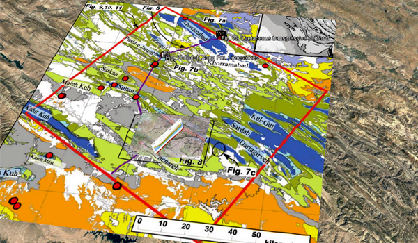
Siah Kuh anticline, SE Lurestan, Zagros, Iran
Virtual Fieldtrip on Google Earth with Elevation Exaggeration = 1 with the geolocation of the main analyzed field localities, geological maps, and cross-sections from the fracture characterization in sigmoidal folds, with insights from the Siah Kuh anticline in the Zagros (Iran) published in the AAPG Bulletin by authors. Assembled by Cristina Biete & Cristina Martínez.
Tazoult Jurassic Diagenesis, Central High Atlas, Morocco
Virtual Fieldtrip on Google Earth with Elevation Exaggeration = 1 with the geolocation of the main analyzed field localities, geological maps, and cross-sections from Jurassic rifting to post-rift subsidence analysis in the Central High Atlas and its relation to salt diapirism by the authors in Basin Research. Assembled by Cristina Martínez
NW Zagros Fold Belt in Kurdistan, Iraq
Virtual Fieldtrip on Google Earth with Elevation Exaggeration = 1 with the geolocation of the main analyzed field localities, geological maps, and cross-sections from the Evolution of the NW Zagros Fold-and-Thrust Belt in Kurdistan Region of Iraq from balanced and restored crustal-scale sections and forward modeling published in the Journal of Structural Geology by authors.Assembled by Cristina Biete & Cristina Martínez.
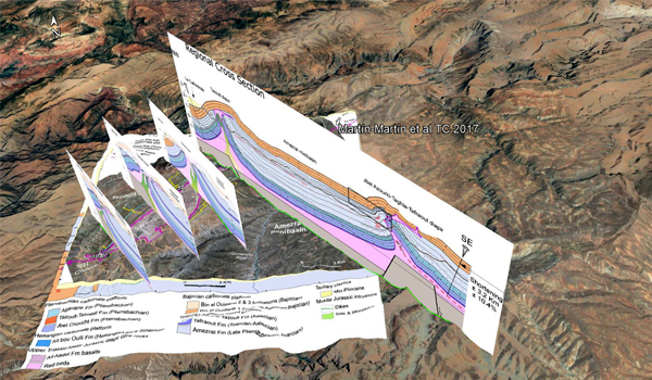
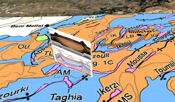
Central High Atlas in Morocco, Tazoult and Jbel Azourki analogue modelling
Virtual Fieldtrip on Google Earth with Elevation Exaggeration = 1, with the geolocation of the balanced cross-section across the Amezraï minibasin from Martín-Martín et al. 2017, model analogue and reconstructed cross-section based on the modelling from. The impact of syn- and post-extension prograding sedimentation on the development of salt-related rift basins and their inversion: Clues from analogue modelling by the authors in Marine and Petroleum Geology. Assembled by Cristina Martínez.
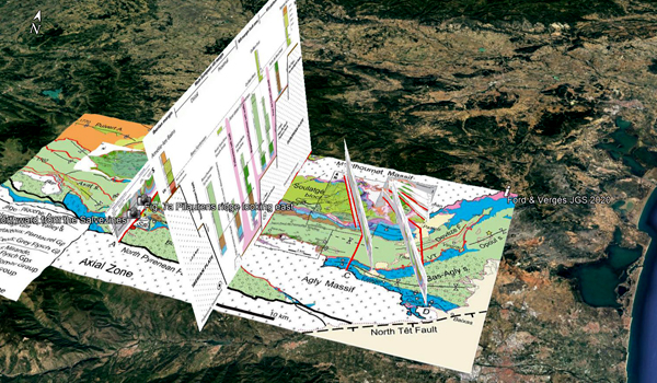
Salt-rifted margin, East North Pyrenees Zone, France
Virtual Fieldtrip on Google Earth with Elevation Exaggeration = 1, with the geolocation of the main analyzed field localities, geological maps, and cross-sections from the Evolution of a salt-rich transtensional rifted margin, eastern North Pyrenees, France paper published in Journal of the Geological Society by the authors. Assembled by Cristina Martínez & Cristina Biete.
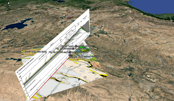
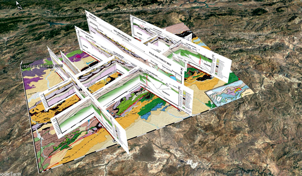
Central Sivas salt-related fold and thrust belt in Turkey
Virtual Fieldtrip on Google Earth with Elevation Exaggeration = 1, with the geolocation of the main analyzed field localities, geological maps, and cross-sections from the Structure and kinematics of the Central Sivas Basin (Turkey): salt deposition and tectonics in an evolving fold-and-thrust belt published in the Geological Society of London as a Spetial Publication by authors. Assembled by Cristina Biete & Cristina Martínez.
Zagros Foreland Fold Belt Timing
Vergés et al., 2019: Chapter 3: Zagros Foreland Fold Belt Timing Across Lurestan to Constrain Arabia-Iran Collision.
Virtual Fieldtrip on Google Earth with the geolocation of the main analyzed field localities, geological maps, and cross-sections from the Zagros Foreland Fold Belt Timing Across Lurestan to Constrain Arabia-Iran Collision published in the in volum 3 – Tectonic and Structural Framework of the Zagros Fold-Thrust Belt in the book Developments in Structural Geology and Tectonics by authors. Assembled by Cristina Biete & Cristina Martínez.
Azanak diapiric anticline in N Dezful embayment, Zagros,
Virtual Fieldtrip on Google Earth with Elevation Exaggeration = 1, with the geolocation of the main analyzed field localities, geological maps, and cross-sections from the Folding, thrusting and diapirism: Competing mechanisms for shaping the structure of the north Dezful Embayment, Zagros, Iran published in the Basin Research Journal by authors. Assembled by Cristina Biete & Cristina Martínez.
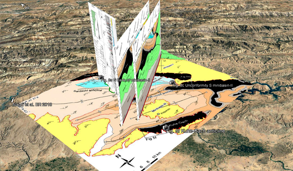
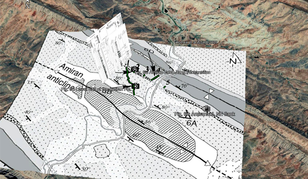
Amiran Basin in Lurestan, Zagros, Iran
Virtual Fieldtrip on Google Earth with Elevation Exaggeration = 1, with the geolocation of the main analyzed field localities, geological maps, and cross-sections from the growth fold controls on carbonate distribution in mixed foreland basins: insights from the Amiran foreland basin (NW Zagros, Iran) and stratigraphic numerical modelling published in the Basin Research Journal by authors. Assembled by Cristina Biete & Cristina Martínez.
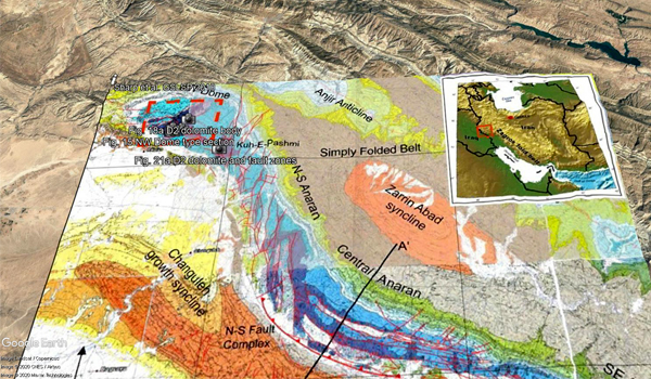
NW Dome of Anaran anticline dolomitization, Lurestan, Zagros, Iran.
Sharp et al., 2010: Stratigraphic architecture and fracture-controlled dolomitization of the Cretaceous Khami and Bangestan groups: an outcrop case study, Zagros Mountains, Iran
Virtual Fieldtrip on Google Earth with Elevation Exaggeration = 1 with the geolocation of the main analyzed field localities, geological maps, and cross-sections from the stratigraphic architecture and fracture-controlled dolomitization of the Cretaceous Khami and Bangestan groups, an outcrop case study in Zagros Mountains (Iran), published in The Geological Society as a Special Publications by authors. Assembled by Cristina Biete & Cristina Martínez.
Amiran anticline, Early foreland, Lurestan, Zagros in Iran
Virtual Fieldtrip on Google Earth with Elevation Exaggeration = 1, with the geolocation of the main analyzed field localities, geological maps, and cross-sections from the Late Cretaceous–Paleocene formation of the proto–Zagros foreland basin, Lurestan Province, SW Iran published in GSA Bulletin by authors. Assembled by Cristina Biete & Cristina Martínez.
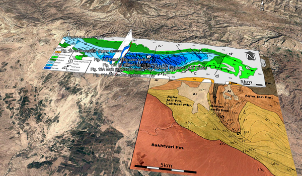
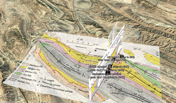
Folding propagation across the Zagros Fold Belt
Virtual Fieldtrip on Google Earth with Elevation Exaggeration = 1, with the geolocation of the main analyzed field localities, geological maps, and cross-sections from the Pliocene growth of the Dowlatabad syncline in Frontal Fars arc: Folding propagation across the Zagros Fold Belt, Iran, published in the GSA Bulletin by authors. Assembled by Cristina Biete & Cristina Martínez.
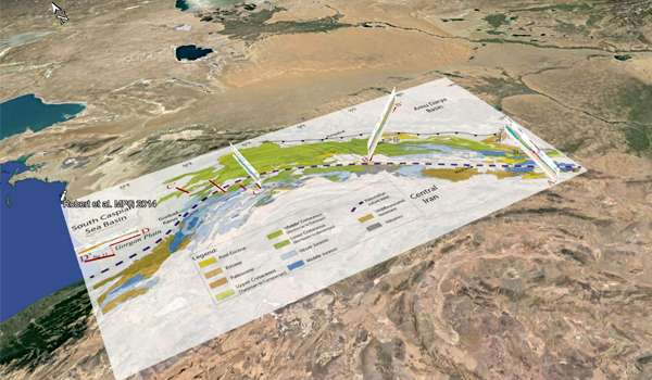
Kopeh Dagh Fold and Thrust Belt – NE Iran, South Caspian Sea and Amu Darya Basin
Virtual Fieldtrip on Google Earth with Elevation Exaggeration = 1 with the geolocation of the main analyzed field localities, geological maps, and cross-sections from the structural evolution of the Kopeh Dagh fold-and-thrust belt (NE Iran) and interactions with the South Caspian Sea Basin and Amu Darya Basin published in the Marine and Petroleum Geology Journal by authors. Assembled by Cristina Biete & Cristina Martínez.
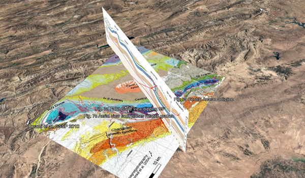
Mountain Frontal Flexure along the Anaran antilcine, Lurestan, Zagros in Iran
Emami et al., 2010: Structure of the Mountain Front Flexure along the Anaran anticline in the Pusht-e Kuh Arc (NW Zagros, Iran): insights from sand box models.
Virtual Fieldtrip on Google Earth with Elevation Exaggeration = 1, with the geolocation of the main analyzed field localities, geological maps, and cross-sections from the structure of the Mountain Front Flexure along the Anaran anticline in the Pusht-e Kuh Arc (NW Zagros, Iran), with insights from sand box models published in The Geological Society as a Special Publications by authors. Assembled by Cristina Biete & Cristina Martínez.
Miravete Salt Anticline, Maestrat Basin
Virtual Fieldtrip on Google Earth with the geolocation of the main analyzed field localities, geological maps, and cross-sections from the Tectono-Sedimentary Evolution of Jurassic-Cretaceous diapiric structures: Miravete anticline, Maestrat Basin, Spain paper published in Basin Research Open Access by the authors. Assembled by Cristina Martínez & Ylènia Almar.
Foreland deposits in the Dezful Embayment, Zagros
Virtual Fieldtrip on Google Earth with Elevation Exaggeration = 1, with the geolocation of the main analyzed field localities, geological maps, and cross-sections from the Provenance evolution of Oligocene–Pliocene foreland deposits in the Dezful embayment to constrain Central Zagros exhumation history published in theJournal of the Geological Society by authors. Assembled by Cristina Biete & Cristina Martínez.

